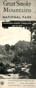
Great Smoky Mountains National Park — A Reader’s Guide

(5 User reviews)   1025
In Category - Geography
United States. National Park Service Project Gutenberg 2023 Not confirmed
Outdoor recreation -- Great Smoky Mountains National Park (N.C. and Tenn.); Great Smoky Mountains National Park (N.C. and Tenn.) -- Description and travel; Great Smoky Mountains National Park (N.C. and Tenn.) -- Maps Readers of public-domain and historical texts
Project Gutenberg digital edition en

Edition facts

Words 6,598
Reading time 29 min
Text sections 17

The catalog record for Great Smoky Mountains National Park — A Reader’s Guide provides practical reading context through 6,598 words, 29 min estimated reading time, and 17 detected text sections.

The text analysis averages about 18.2 words per sentence, while the detected sections provide another way to judge how the source is divided.

Project Gutenberg metadata also associates the work with “Outdoor recreation -- Great Smoky Mountains National Park (N.C. and Tenn.),” connecting these edition facts with the source record’s subject description.

This editorial note examines the language, narrative voice, and shifts in pace within the National Park Service's 1954 guide to Great Smoky Mountains National Park, highlighting its blend of scientific description, historical narrative, and practical trail information.
Share
Editorial Edition Score 4.6/5

Calculated from edition completeness, EPUB availability, text structure and catalogue metadata. Not a user rating.

How this score is calculated
  • Description quality20 pts
  • Title & short description10 pts
  • Source metadata20 pts
  • Text length15 pts
  • Chapters / structure15 pts
  • EPUB file integrity20 pts

Total of 100 points, scaled to a 2.5-5.0 range. Editions with an empty description or a missing EPUB file are not scored.

Edition quality

Read the Text

m began a century ago, was the first to describe the Great Smoky Mountains from personal observation. He wrote:

“Although the high peaks of the Smoky mountains are some fifty feet lower than the isolated and almost exceptional group of the Black mountains, by their number, their magnitude, the continuity and general elevation of the chains, and of the base upon which they repose, they are like a massive and high citadel which is really the culminating region of all the Appalachian System.”

Prior to the start of the 20th century, the area now comprising the park was little known to the outside world, although DeSoto is believed to have viewed the mountains. They were, and still are, the home of the Cherokees who now occupy the Cherokee Indian Reservation in North Carolina, adjacent to the park on the south. The few white settlers were the rugged mountaineer descendants of colonists from England and Scotland who lived isolated and primitive lives. The Great Smokies region became better known during and subsequent to World War I when logging railroads of lumber companies penetrated some of its virgin forests. Still later, highways skirted the area and visitors were able to view its majestic peaks from a distance.

The successful movement for the creation of a national park in this area was begun in 1923, and its establishment was authorized by the Federal Government by act of Congress approved May 22, 1926. Enabling acts were passed by the State legislatures of North Carolina and Tennessee in 1927, and land acquisition was begun with State funds, matched by a generous donation made by John D. Rockefeller, Jr., through the Laura Spelman Rockefeller Memorial, in honor of his mother. Subsequently, Federal funds were made available for the completion of the project.

On February 6, 1930, the Governors of North Carolina and Tennessee presented the Secretary of the Interior with deeds to an initial 158,876 acres of land on behalf of their respective States. A limited park was thus established for administration and protection. The park, now containing 507,168 acres of Federal lands, was formally dedicated on September 2, 1946.

Pioneer Culture in the Great Smokies

Great Smoky Mountains National Park presents an opportunity to preserve frontier conditions of a century ago. The cultural and human interest aspects of this park are exceeded only by its scenery and natural history.

In places where the forest has not yet encroached upon them, there are clearings which were the sloping little farms of the mountain pioneers. Sturdy log structures in varying stages of disintegration remain there as evidence of a way of life which has practically disappeared in eastern United States. Some of these log cabins, barns, and other buildings have been rehabilitated in place so that you may see the original structures in their true setting. Most of them are in Cades Cove, where the park’s only grist mill powered by an overshot wheel is located. Cades Cove, an isolated, oval-shaped valley surrounded by mountains, is a region of outstanding pastoral charm which you should visit.

Some of the finest of various types of authentic pioneer structures have been assembled in the immediate vicinity of the Oconaluftee Ranger Station and Pioneer Museum, located on the cross-mountain highway about 2 miles north of Cherokee, N. C. On display in the museum are tools, household objects, and a variety of other handmade items which were used by the pioneers who made their homes on lands which now comprise the park. This building is open from 9 a. m. to 5 p. m., April through October.

The Cherokee Indian Reservation

You will be interested in the Cherokee Indians on the Cherokee Reservation, which is immediately south of the park. Although the Government has instituted here a comprehensive system of education and modern methods of living, ancient ceremonies and sports are preserved as tribal customs.

Crowning the highest peaks with spruce and fir and carpeting the mountainsides with a wealth of deciduous trees is an unbroken forest cover, which cannot be matched in eastern America. In all of Europe there are not as many species of native trees as are to be found in Great Smoky Mountains National Park. A number of these, such as Canada hemlock, silverbell, red spruce, yellow buckeye, and mountain-ash grow to record size, while others become giants of their kind. Approximately 40 percent of the more than half-million acres which comprise the park are in the original forested condition. A total of 130 native tree species are known to grow in this area.

Few, if any, areas in the eastern United States possess so great a variety of plants. Altogether, the tree, shrub, and herb varieties total more than 1,300. Botanists have also listed over 1,800 species of fungi, 330 mosses and liverworts, and 230 lichens. The earliest flowers occasionally appear by the close of February in lowland areas, while the witchhazel, latest to bloom, may hold its blossoms into December. Late April finds the spring flowers, including the abundant dogwood, at their blossoming peak; May is best for the mountain laurel; middle June usually finds both the flame azalea and rose-purple rhododendron at their finest; middle July is likely to be the peak of the great white rhododendron’s flowering. Autumn colors are excellent throughout October, with the height of coloration near the end of the month.

Here, as in all national parks, wildlife is given complete protection. No hunting or trapping is permitted. Since establishment of the park, the black bear population has increased considerably, and such animals as the white-tailed deer, red and gray foxes, raccoon, bobcat, wild turkey, ruffed grouse, and others find sanctuary in these mountains. More than 52 species of fur-bearing animals, some 200 birds, 36 reptiles, 37 amphibians, and 80 fishes are known to live here.

=The feeding, touching, teasing, or molesting of bears is prohibited.= This regulation is enforced strictly for the protection of the public. Persons using park trails have nothing to fear from unmolested bears. If tempted by food, however, some bears, which frequent sections of the motor road, become dangerous. They should not be fed or approached. Persons using the Appalachian Trail shelters can protect their food supplies by suspending them from tree limbs outside the shelter.

Approximately 600 miles of streams, many of them well suited to trout, flow down the slopes of the Great Smoky Mountains. Each year thousands of hatchery-reared trout are released in the more heavily fished waters. Rainbow and brook trout and small-mouth bass lure the devotees of Izaak Walton. Persons fishing in park waters must have the State or county license issued and required by North Carolina, or the State license issued and required by Tennessee, depending upon the section of the park being fished. Catches are regulated, and some streams may be found closed for restocking. The fishing season is from May 16 to August 31. Current regulations may be obtained from the office of the superintendent or from park rangers or wardens.

Beginning in May and continuing for 6 months, a program of naturalist-guided field trips and talks is available. This service is maintained by the Government and is free to the public.

Naturalists meet hikers at designated points in or near the park and conduct visits to outstanding objectives over good trails. Plant and animal life is discussed informally along the way. There are several types of walks ranging from 2 hours to all day. Illustrated talks are given in the evenings at regular intervals, chiefly in hotel lobbies and other points of visitor-concentration.

Programs describing the nature-guide service are available (May-October) at headquarters and at Oconaluftee Ranger Station and are posted in hotels and various places throughout the park.

Free modern campgrounds are provided on the Tennessee side of the park at the Chimney Tops, 6 miles south of Gatlinburg, and Cades Cove, 7 miles from the Townsend entrance to the park; on the North Carolina side at Smokemont, on the transmountain highway, Balsam Mountain, 10 miles from Soco Gap on U. S. 19 (Blue Ridge Parkway spur), and Deep Creek, 2 miles from Bryson City. Aside from these campgrounds, the only accommodations in the park are at Le Conte Lodge on the top of Mount Le Conte, accessible only by foot or horseback. For reservations and rates, write Jack Huff, Gatlinburg, Tenn.

A number of hotel and tourist courts are available in cities and towns near the park, and at Knoxville and Asheville. Inquiries regarding these accommodations should be addressed to Knoxville Tourist Bureau, Henley Street, Knoxville, Tenn.; East Tennessee Automobile Club, Knoxville, Tenn., Chambers of Commerce of Gatlinburg, Knoxville, and Maryville, Tenn., Asheville, Waynesville, Bryson City, and Sylva, N. C.; Cherokee Association, Cherokee, N. C.; and Government Services, Inc., Fontana Village, Fontana Dam, N. C.

Great Smoky Mountains National Park is administered by the National Park Service of the United States Department of the Interior. A superintendent, whose address is Gatlinburg, Tenn., is in immediate charge. Park headquarters are located 2 miles south of Gatlinburg. A member of the protection division maintains headquarters at Oconaluftee Ranger Station, N. C., on U. S. 441; post office, Cherokee, N. C.

Help Us Protect This Park

Please note the following requirements which are necessary for the protection of the natural beauties of the park, as well as for your comfort and convenience:

The park is a sanctuary for all living things. It is a violation of the law to destroy, injure, or disturb trees, shrubs, flowers, birds, animals, or any natural feature in the park.

The speed limit is 35 miles an hour, unless otherwise posted. Drive carefully; keep to the right. Report all accidents to a park ranger.

Camping or lighting fires at places other than designated campgrounds or picnic areas is not allowed, except by permit. To camp in remote sections of the park, except during periods of high fire hazard, permits may be secured at the office of the superintendent, the Oconaluftee Ranger Station, or from the district park rangers or wardens. Camping is restricted to certain periods at the campgrounds. Individual sites provided with fireplaces and water are available.

Please help to keep the park clean. Do not scatter papers, picnic remnants, and the like; use trash receptacles along roads, in picnic areas, and campgrounds.

Fire is one of the greatest dangers to the park. Put out fires completely upon leaving. Be sure cigarettes and matches are out before disposal. Lunches may be eaten along roadsides, but fires should not be built.

Only those persons having special permits may collect botanical or geological specimens in the park. Such permits may be secured by competent scientists upon application to the superintendent.

Dogs and cats are permitted in the park if on leash, crated, or otherwise under physical restrictive control at all times.

The feeding, touching, teasing, or molesting of bears is prohibited.

Deliberate infraction of park regulations may bring penalty of fine or imprisonment or both.

Revised 1954 16—53420-6 GPO

COMPLETELY EXTINGUISH MATCHES AND CIGARETTES BEFORE THROWING AWAY. BE SURE CAMPFIRE IS OUT BEFORE LEAVING IT. ALWAYS USE CAR ASHTRAYS. LET'S NOT BE GUILTY OF STARTING A FOREST FIRE.

| From— +————————————+——————————+————————— To— | Gatlinburg | Cherokee | Townsend | entrance | entrance | entrance ———————————————————————————————+————————————+——————————+————————— | _Miles_ | _Miles_ | _Miles_ Park Headquarters | 1.5 | 28.3 | 18.5 Pioneer Museum and Oconaluftee | 27.9 | 1.9 | 45.9 Ranger Station | | | Chimneys Campground | 6.5 | 23.6 | 23.5 Smokemont Campground | 24.6 | 5.2 | 41.5 Balsam Mountain Campground | 53.3 | 23.5 | 71.3 | | | Cades Cove Campground | 26.0 | 63.0 | 7.7 | | | Deep Creek Campground | 45.8 | 16.0 | 63.8 | | | Heintooga Ridge Picnic Area | 53.8 | 24.0 | 71.8 Chimneys Footbridge | 8.7 | 21.1 | 25.7 Alum Cave Parking Area | 10.5 | 19.3 | 27.5 Cherokee Orchard | 4.7 | 35.5 | 24.7 Newfound Gap | 15.0 | 14.8 | 42.0 | | | Indian Gap | 16.3 | 16.1 | 43.3 Forney Ridge Parking Area | 22.5 | 22.3 | 49.5 | | | Fighting Creek Gap | 4.6 | 31.4 | 15.4 Cherokee Indian Reservation | 31.3 | 1.5 | 48.5 Little River Gorge | 5.8 | 32.5 | 1.0 | | | Cades Cove | 26.0 | 63.0 | 7.7 Tremont “Y” | 18.2 | 45.0 | 0.7 Greenbrier | 11.0 | 43.0 | 31.0 Cosby | 23.1 | 52.0 | 43.1 Cataloochee | 50.4 | 60.5 | 70.4 Loop trip around western end | 165.0 | 165.0 | 165.0 of park | | | ———————————————————————————————+————————————+——————————+—————————

To— |Elevation| Remarks | Map | | |Index ——————————————————————+—————————+———————————————————————————————+——————— | _Feet_ | | Park Headquarters | 1,463 | Office of superintendent | F-2. Pioneer Museum and | 2,025 | Museum; park office, | I-4. Oconaluftee Ranger | | North Carolina section | Station | | | Chimneys Campground | 2,750 | In Tennessee section on | G-3. | | U. S. 441 | Smokemont Campground | 2,198 | In North Carolina section on | I-4. | | U. S. 441 | Balsam Mountain | 5,340 | In North Carolina section; | J-4. Campground | | 11.3 miles north | | | of U. S. 19 | Cades Cove Campground | 1,960 | In Tennessee section; 7 miles | C-3. | | south of Tennessee Route 73 | Deep Creek Campground | 1,800 | In North Carolina section; 2.1| G-5. | | miles north of U. S. 19 | Heintooga Ridge | 5,325 | Excellent mountain vistas | J-4. Picnic Area | | | Chimneys Footbridge | 3,550 | At parking area above lower | G-3. | | tunnel | Alum Cave Parking | 3,850 | Trail to Alum Cave Bluffs | G-3. Area | | and Mount Le Conte | Cherokee Orchard | 2,550 | Trails to Mount Le Conte and | G-2. | | Rainbow Falls | Newfound Gap | 5,048 | Where U. S. 441 crosses | G-3. | | Smokies, Appalachian Trail, | | | and Clingmans Dome Highway | Indian Gap | 5,266 | Historic pass through Smokies | G-3. Forney Ridge Parking | 6,311 | Clingmans Dome Trail | G-4. Area | | | Fighting Creek Gap | 2,320 | Trail to Laurel Falls and | F-2. | | Cove Mountain | Cherokee Indian | 1,900 | Eastern band of Cherokee | I-5. Reservation | | Indians | Little River Gorge | 2,000 | Scenic drive |E-2 and |to 1,100 | | D-2. Cades Cove | 1,807 | Extensive level area | C-3. | | surrounded by mountains | Tremont “Y” | 1,147 | Junction of Cades Cove and | D-3. | | Little River Roads | Greenbrier | 1,680 | Trails into area of excellent | H-2. | | forests and streams | Cosby | 2,459 | Northeastern section of park, | J-1. | | Tennessee side | Cataloochee | 2,643 | Excellent scenic drive, | K-3. | | eastern section of park | Loop trip around | ... | One-day drive, Gatlinburg to | western end of park | | park headquarters, Elkmont, | | | Townsend, Maryville, Tapoca,| | | Bryson City, Cherokee, and | | | Gatlinburg | ——————————————————————+—————————+———————————————————————————————+———————

How To Reach the Park

Paved highways from all States converge at Knoxville, Tenn., and Asheville, N. C. Bus lines maintain service to both cities. The Southern Railway and the Louisville & Nashville Railroad serve Knoxville; the former also serves Asheville. Knoxville may also be reached by American, Capital (PCA), and Delta Airlines; Asheville, by Capital (PCA), Delta, and Piedmont Airlines. Trailways buses make seven trips each way, daily, between Knoxville and Asheville, going through the park via Gatlinburg and Cherokee. North Carolina towns bordering the park may be reached by direct buses from Atlanta and Chattanooga. Excursions by bus also may be made from Knoxville, stopping overnight at Gatlinburg and continuing to Knoxville via Maryville, Tenn. Smoky Mountain Tours, Inc., with offices in both Knoxville and Asheville, operate personally conducted sightseeing stages through the park between the two cities frequently during the summer. The Southern Railway offers both one-way and round-trip tickets, providing travel by bus through the park between Knoxville and Asheville.

Summer days are usually warm or hot in the lowland areas and cool in the higher mountains; the nights are cool.

Spring arrives early in the lowland areas and progressively later at higher elevations. Weather conditions are particularly favorable in autumn, with less rainfall at that season. Winters are variable, both as to severity and length, but they normally are mild in the lowlands.

Rain, snow, and fog often are encountered in the mountains during the winter. Roads are kept open all year, but the transmountain highway sometimes is closed for a few hours during heavy snow or sleet storms when snowplows cannot keep it open. Snows are infrequent in the park, but you should take chains if you plan to drive through in winter. Roads are posted if driving conditions are unfavorable.

Horses, Pack Animals, and Guide Service

In some of the towns bordering the park, horses and pack animals, with guide service, may be rented by the hour, day, or for longer periods.

Destination | Trail starts |Elevation ———————————————————————————+——————————————————————————————+———————— | | _Feet_ Laurel Falls |Fighting Creek Gap (see Road | 2,500 | Distances) | Clingmans Dome Summit |Forney Ridge Parking Area | 6,643 Andrews Bald |Forney Ridge Parking Area | 5,860 Alum Cave Bluffs |Alum Cave Parking Area (see | 4,900 | Road Distances) | Mount Le Conte: via Alum |Alum Cave Parking Area (see | 6,593 Cave Bluffs | Road Distances) | via Boulevard |Newfound Gap (see Road | 6,593 | Distances) | via Cherokee Orchard |Cherokee Orchard via Rainbow | 6,593 | Falls | |Cherokee Orchard via Bullhead | 6,593 |Cherokee Orchard via Trillium | 6,593 | Gap | via Roaring Fork |Gatlinburg and Trillium Gap | 6,593 The Jumpoff |Newfound Gap | 6,100 Charlies Bunion |Newfound Gap | 5,375 Gregory Bald |Cades Cove | 4,948 Chimney Tops |Chimneys Bridge (see Road | 4,755 | Distances) | Mount Cammerer |Davenport Gap | 5,025 Ramsey Cascades |Greenbrier | 4,750 Raven Fork Wilderness |Smokemont | 4,202 Mount Sterling Tower |Mount Sterling Gap | 5,835 Sharp Top on Noland Divide |Bryson City (at park line) | 3,430 Bryson Place |Bryson City | 2,411 ———————————————————————————+——————————————————————————————+————————

| Distance | | Map Destination |round trip| Remarks |Index —————————————————————+——————————+—————————————————————————————————+————— | _Miles_ | | Laurel Falls | 2.5 | One of the most popular hiking | E-2. | | trips | Clingmans Dome Summit| 1.0 | One-half mile paved trail leads | G-4. | | to one of the highest peaks | | | in East; highest in park. | Andrews Bald | 4.0 | One of the most popular hikes | G-4. | | in park. | Alum Cave Bluffs | 5.0 | Easy trail, fine views. Best | G-3. | | for rose-purple rhododendron | | | in mid-June. Alum Cave Bluffs.| Mount Le Conte: via | 10.4 | Shortest way to Mount Le Conte | G-3. | | and very spectacular. | Alum Cave Bluffs | | Foot trail only. | via Boulevard | 16.0 | Follows Appalachian Trail to | G-3. | | Mount Kephart and | | | thence along Boulevard Trail | | | to Le Conte. | via Cherokee | 13.4 | Trail passes Rainbow Falls and | G-3. Orchard | | around Rocky Spur. | | 14.4 | Trail passes around Bullhead. | G-3. | | | | 16.8 | Good horse trail. | G-3. via Roaring Fork | 22.4 | Longest trip to Mount Le Conte, | G-3. | | but interesting. | The Jumpoff | 6.5 | Jagged mountain peaks. | H-3. Charlies Bunion | 8.6 | Reminiscent of the rugged | H-3. | | Rockies. | Gregory Bald | 11.0 | Best display of wild azalea in | B-4. | | mid-June. | Chimney Tops | 3.0 | For the experienced hiker. | G-3. | | 3 hours, round trip. | Mount Cammerer | 12.0 | Fine view of valleys and | K-1. | | mountains. | Ramsey Cascades | 12.0 | Largest cascades; stands of | I-2. | | virgin hardwoods. | Raven Fork Wilderness| 16.0 | Largest stand of virgin red | J-3. | | spruce and balsam. | Mount Sterling Tower | 5.2 | Accessible fire tower. | K-2. Sharp Top on Noland | 4.0 | Interesting hike. | G-5. Divide | | | Bryson Place | 20.0 | Follows Deep Creek to Bryson | H-4. | | Place, and Nettle Creek into | | | a fine stand of virgin | | | hardwoods. | —————————————————————+——————————+—————————————————————————————————+—————

There are 66 miles of high standard roads in the park including the transmountain highway from Gatlinburg, Tenn., to Cherokee, N. C. Clingmans Dome Highway reaches an altitude of 6,311 feet. Seventy miles of secondary roads and 653 miles of horse and foot trails are available for hiking and riding.

The park highways offer exceptional opportunities to view the grandeur of the Great Smokies. Spur roads and trails lead to many points of interest.

There are trails of all types to suit your individual requirements. Some are 4 feet wide on easy gradients; some are improved footpaths; others merely tracks through the forest. Park forces try to keep trails drained and clear of brush and other obstacles; but the country is rough, and hikers should wear suitable outdoor clothing, including stout low-heeled shoes. If you are an inexperienced hiker, you should be especially careful and watch your footing on the trails.

The Appalachian Trail

The Appalachian Trail crosses the park and follows the ridge of the Smokies for most of its 71 miles. The eastern portion, from Davenport Gap at the northeast corner to Newfound Gap on the transmountain highway, is 31 miles long and follows through an absolute wilderness. The western portion from Newfound Gap to Fontana Dam just outside the park, is 40 miles long. Most of the trail is over 5,000 feet in elevation.

There are 7 trailside shelters and 3 trailside campsites along the 71-mile section of the Appalachian Trail in this park from Davenport Gap to Newfound Gap (31 miles) and Newfound Gap to Fontana Dam (40 miles). These are nearly equally spaced for 1-day hiking trips. Shelters are closed on 3 sides and provide simple bunk accommodations for 6 persons. A fireplace is in front and water is available nearby. Use of the shelters is normally restricted to 1 night. Camping is permitted along the trail only at the above points and a camping permit for each trip is required. (See page 8.) Because of the scarcity of fuel at these sites, you are advised to carry primus-type stoves.

The National Park Service's 1954 guide to Great Smoky Mountains National Park opens with a striking blend of scientific precision and lyrical description. The text immediately establishes the park's geological antiquity, noting that the mountain range 'zigzags through the park from northeast to southwest for 71 miles' and that 'sixteen of its peaks rise more than 6,000 feet.' Yet it also reaches for a poetic register when it attributes the mountains' name to the 'deep blue haze rising from the valleys to the summits.' This dual voice—factual yet evocative—persists throughout the guide, shaping how readers encounter both the park's natural history and its practical offerings.

Scientific Authority and Descriptive Cadence

The guide frequently invokes expert testimony to bolster its descriptions. The geographer Arnold Guyot is quoted at length, his nineteenth-century prose lending a stately, almost monumental rhythm: 'by their number, their magnitude, the continuity and general elevation of the chains, and of the base upon which they repose, they are like a massive and high citadel.' This quotation is not merely decorative; it anchors the park's significance within a tradition of scientific exploration. The text's own voice mirrors this cadence in passages about vegetation, calling the region 'the cradle of the present vegetation of eastern America.' Such phrasing elevates the guide beyond a mere itinerary, positioning the park as a subject worthy of scholarly attention.

Shifts in Pace: From Historical Narrative to Practical Directives

The guide's pacing changes markedly when it moves from historical background to visitor logistics. Early sections unfold in broad, sweeping sentences that trace the park's creation from 'the successful movement for the creation of a national park in this area was begun in 1923' to its authorization by Congress. But as the text turns to roads and trails, the prose becomes terse and imperative. Sentences shorten: 'Roads are kept open all year, but the transmountain highway sometimes is closed for a few hours during heavy snow.' Lists of hikes appear in tabular form, with columns for trail starts, elevations, and distances. This abrupt shift from narrative to data reflects the guide's dual purpose—to inspire and to instruct—and forces the reader to adjust their reading pace accordingly.

Voice of Authority and Implied Audience

The guide's voice is consistently that of an institutional expert addressing a visitor presumed to be inexperienced. Phrases like 'if you are an inexperienced hiker, you should be especially careful' and 'you should take chains if you plan to drive through in winter' establish a paternalistic tone. The text assumes the reader needs warnings about snow, steep trails, and proper footwear. Yet this authority is tempered by an evident pride in the park's amenities: 'The park highways offer exceptional opportunities to view the grandeur of the Great Smokies.' The guide never addresses the reader as a peer; instead, it functions as a benevolent overseer, dispensing both knowledge and caution. This consistent voice unifies the guide's disparate sections, from geological exposition to trail recommendations.

Readers approaching this guide should attend to its shifts in register—from the measured cadence of scientific description to the clipped urgency of practical advice. The text rewards those who read it as a layered document, one that reveals as much about mid-century park management as about the Smokies themselves. Pay particular attention to the way the guide balances its roles as natural history, promotional brochure, and safety manual, for that balance is the key to its enduring interest.

I read that old park guide slowly, savoring how it blends dry trail notes with quiet wonder at the mountains. It left a lingering warmth, the way a remembered voice does. I found a similar echo in Brazil and La Plata: The personal record of a cruise — Context and Discussion—that same patient, observant eye on land and water, told like a letter home.

Joseph Hill
1 month ago

Avery Sanchez
2 weeks ago

Sebastian Hall
2 weeks ago

Ella King
2 weeks ago

Sebastian Jones
1 month ago

5
5 out of 5 (5 User reviews )

Add a Review

Your Rating *
  • ...
    Latoya Barnett - 1 month ago
    A useful introduction to the Smokies, covering key attractions and natural features. The writing is clear, but the lack of current visitor information makes it less practical. Still, it captures the essence of the park's beauty and history.

  • ...
    Michael Fuller - 1 month ago
    Time hasn't been kind to this outdated guide. Information on facilities and trails is likely obsolete, and the coverage is shallow. More of a pamphlet than a comprehensive book, it fails to deliver the depth needed for serious hikers. Read the park's official website instead.

  • ...
    Melinda Cochran - 2 weeks ago
    A beautiful and informative guide to one of America's most stunning national parks. Detailed hiking trails, geological insights, and cultural history are presented in an accessible manner. The photography, though not in this text edition, is vividly described. Essential reading for nature lovers planning a visit.


Reader reflection

Your personal reading reflection

Build a private reading journal entry for this title.
Your progress 0 / 10
1

How far have you progressed with this book?

2

Did this book hold your interest?

3

Would you recommend this book to another reader?

4

How easy was the book to follow?

Related eBooks