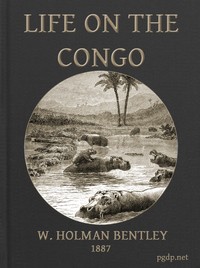
Life on the Congo — Edition Insights
Edition facts
Life on the Congo — Edition Insights can be approached with a clearer sense of reading commitment from its source measurements: 25,842 words, 1 hr 53 min estimated reading time, and 12 detected text sections.
The text analysis averages about 22.3 words per sentence, while the detected sections provide another way to judge how the source is divided.
Project Gutenberg metadata also associates the work with “Africa, Central -- Description and travel,” connecting these edition facts with the source record’s subject description.
Calculated from edition completeness, EPUB availability, text structure and catalogue metadata. Not a user rating.
How this score is calculated
- Description quality20 pts
- Title & short description10 pts
- Source metadata20 pts
- Text length15 pts
- Chapters / structure15 pts
- EPUB file integrity20 pts
Total of 100 points, scaled to a 2.5-5.0 range. Editions with an empty description or a missing EPUB file are not scored.
Read the Text
The Discovery of the Congo.
In 1484 Diogo Cam, a Portuguese navigator, first sighted the mouth of the Congo River. Four centuries have since elapsed, and only now have we the definite knowledge of the course of that mighty flood. Seven years after the discovery of the river, an embassy was sent to the capital of the Congo country, known as San Salvador; Roman Catholic missionaries followed, who in time penetrated some 250 miles into the interior. They made, however, San Salvador their head-quarters and cathedral city, but were finally expelled by the Governor of Angola some 130 years ago. They appear to have kept away from the river; what records of their work remain throw no light as to its course. The slave trade flourished in the mouth of the river, but interiorwards the land remained unknown.
In 1816 Captain Tuckey was commissioned by the Admiralty to endeavour to solve the mystery, and was instructed to ascertain whether there was any connection between the Niger and the Congo. This ill-fated expedition penetrated to a distance of 150 miles from the coast. And this was the extent of our knowledge of its lower course until recently.
In 1871 Dr. Livingstone, travelling westward from the Lake Tanganika, discovered a great river flowing northward, called by the natives Lualaba. After three and a half months he returned to the Tanganika, and finally striking south, died at Ilala, on the south of Lake Bangweolo, the upper waters of the Congo-Lualaba, in April, 1873.
Lieut. Cameron, commissioned by the Royal Geographical Society to carry fresh supplies and aid to Dr. Livingstone, met his dead body being conveyed to the coast by his faithful servants. Continuing his journey with the material he hoped to deliver to the Doctor, he crossed the Tanganika, and reached Nyangwe, the point where Dr. Livingstone had first sighted the Lualaba. He would have followed the course of the mysterious river; but was unable to induce his men to attempt the solution of the problem, and striking southwards skirted the lower edge of the Congo Basin, and reached the west coast at Benguela in November, 1875.
In 1874 the _Daily Telegraph_ and _New York Herald_ combined to send Mr. Stanley to Africa, to complete the geographical discoveries of Dr. Livingstone.
In _Les Belges au Congo_, the excellent Christmas number of _Le Mouvement Géographique_, the official organ of the International African Association, we have a sketch of the life of the greatest living explorer. Born at Denbigh, in North Wales, in 1840, John Rowlands lost his father at two years of age; he was educated at the parish school of St. Asaph. At the age of sixteen he worked his passage to New Orleans, where he obtained employment in the house of a merchant named Stanley. He rose rapidly in favour and esteem, until the sudden death of his employer destroyed his hopes. Assuming the name of his benefactor, Henry Moreland Stanley was enrolled in the Confederate army when the War of Secession broke out in 1861. He was made prisoner at the battle of Pittsburg, in 1862, but effected his escape. Constantly exposed to arrest as an escaped prisoner, he engaged himself as a sailor in the Federal Marine, in which he obtained rapid promotion, becoming secretary to the Captain of the Ticonderoga, and later held the same position under the Admiral.
He accompanied his vessel on a European cruise, and obtained his discharge at the end of the war. He was next correspondent of the _Missouri Democrat_, and the _New York Tribune_, and later became travelling correspondent to the _New York Herald_, for which he accompanied the British forces during the Abyssinian and Ashantee wars. After those he made a journey through Asia Minor, the Caucasus and Persia to India, thence by Egypt to Spain, where he received his commission to find Livingstone.
That successful expedition marked him as the man to carry on further exploratory work in Africa; and when the news of Dr. Livingstone’s death reached Europe, fired with the desire to carry on the work of the great Doctor, he gladly accepted the commission of the _Daily Telegraph_ and _New York Herald_.
Starting from Zanzibar November 17, 1874, he circumnavigated the Lakes Victoria Nyanza and Tanganika for the first time, carefully charting. Thence he struck across to Nyangwe. In spite of the obstacles and difficulties that had hindered others, his immense determination, his resources, and knowledge of the Swahili language, enabled him to induce his men to follow him down the river.
He recalled to their minds the long weary marches, the terrible dank forests of Urega, how easy it would be to sit in canoes, and paddle down this great river, which must flow into the sea. They agreed, and met the first serious impediment to navigation at the Equator, where a series of seven cataracts in forty miles caused them to transport their canoes overland round these obstacles.
Clear of these Stanley Falls they had an uninterrupted course for 1,060 miles, the river widening out in some places to as much as twenty-five miles in breadth, studded with low sandy tree-covered islands. As he neared the end of this grand reach of waterway, hills appeared, the river narrowed, and the banks grew steeper until they towered a thousand feet above him. The river widened out once more into a pool some seventy miles in circumference, which is now named Stanley Pool, at the western end of which the explorer heard the thunder of the Ntamu Cataracts. From this point his difficulties were to be of a different nature. Along the 1,000 miles of clear waterway which he had just passed, he had been exposed to the constant attacks of wild, fierce savages, now he had to struggle with a wilder, fiercer river. The next one hundred miles occupied four months. Dragging his canoes overland, past the Ntamu Cataracts, he took once more to the water, only to find another cataract a few miles lower down. This was his constant experience, while the porterage past these obstacles often involved the conveyance of his heavy canoes, stores, etc., 700 and 1,000 feet up the steep banks of the river, four or five miles overland, and down again into the deep gorge. Stores were running short, food was scarce, canoes were lost in the rapids, some of his men were drowned, including Frank Pocock, his only surviving white companion. Privations, sickness, and murderous natives had thinned his ranks, but he struggled on. Clearing the Ntombo Mataka Falls, he found a reach of ninety miles of very bad, but navigable water, and at the end of which were the great Isangila Falls. There, learning that he was within a few days’ journey of factories and white men, he left the river, and his weary company toiled over the steep quartz hills and reached Mboma in August, 1877, in an almost starving condition. A year of drought and great scarcity of food had added much to his difficulties. However, the journey was accomplished, the Congo River had been traced, the highway into the heart of Africa had been explored. Taking his people down the last quiet sixty miles of the river, he arranged for their return to Zanzibar, via the Cape of Good Hope. Having seen them safe home again, and rewarded their devotion and toil, he reached England to announce his great discovery.
The Physical Features of the Congo.
Roughly we may describe the Basin of the Congo as extending from the 5th degree of North, to the 12th degree of South, latitude, and from the hills skirting the coast of the Atlantic Ocean to 31st or 32nd degree of East longitude.
Along what is known as the South-West Coast of Africa, from the Gulf of Biafra southwards, stretches a ridge of hill country. It commences about fifty to seventy miles inland, and is about 300 miles in width. In some parts it attains an elevation of 5,000 or more feet, but the general altitude near the Congo is from 2,000 to 2,500 above the level of the sea. It is really a belt or elevated plateau; rich soil is to be found on the summits of the ‘hills,’ but the whole has been torn and worn by the rains; little streams have in time cut out deep gorges, the sides of which are being further eroded, until what was once a rolling table-land appears as a chaos of hills; only from a few heights can one gain a fair idea of the nature of the country.
This plateau belt forms the western watershed of the Congo River, and on its seaward slopes gives rise to many unimportant streams, of which the Cameroons, Gaboon, Ogowai, Kwilu, Chiloango, Mbidiji, (Ambrize), Loje, and Kwanza are the principal. The Ogowai is the most important, and has been explored by M. de Brazza for the French Government, which has now annexed its entire basin. It is navigable for some 150 miles for vessels of light draught; but beyond its course is much impeded by cataracts.
This water-torn plateau country, with its little useless rivers, has presented a formidable obstacle to exploration, and has served to throw all interior water into the Congo. To the north of the Great Basin stretches the high lands of the unknown countries which form also the watershed of the Shari and the Nile. Eastward stretches the hill country on the west of the Victoria and Albert Nyanza, and on the east of Tanganika, while to the south is the watershed of the Zambesi.
This great circle of hills probably enclosed at one time an immense fresh-water lake, of an area of a million and a half square miles, which at length, overflowing at its weakest point, formed the outlet which we to-day call the Congo River. The immense flood thus released tore out the deep gorge, which is now 1,000 and 1,500 feet below the main level. There are signs in some parts of changes in its course, one notably in the Bundi valley, thirty-five miles from Vivi, which was at one time undoubtedly a channel of the Congo; there are other valleys also presenting that appearance, the levels, entrances, and exits of which would lead one to conclude that such had been the case.
If a transverse section were taken about the middle of the cataract region, there would be first an ascent from the river, almost perpendicular, of from 300 to 500 feet in about one-third of a mile, then a much steadier rise of some 500 to 700 feet in two miles, and then a rise of another 500 to 700 feet in eight miles, with a further steady rise for five miles, so that the actual valley in the cataract region might be estimated roughly at from twenty to thirty miles in breadth. The river itself varies from 300 yards to one-and-a-half or two miles wide at mid-flood; while the difference between the highest water of the rainy season and the lowest in the dry season, varies from forty feet in the worst parts to about three feet on the lower river.
To the geologist the country between the coast and Stanley Pool is best studied along the river. The first low hills approach near to the mouth of the river, which is about seven miles wide, and devoid of a delta; the next step in the plateau occurs at five miles west of Mboma, fifty miles from the coast, where the tops of the ‘hills’ are from 500 to 700 feet in height. There we find a red clay yielding copal above granitic rocks. The banks grow steeper and the river narrows, until at Vivi the first serious obstacle is met, the plateau level being about 1,700 feet, and the river about 600 yards wide. Just above this is the fierce Yelala Cataract; indeed, nowhere can you properly speak of falls; a drop of fifty feet, which would be a fine scene on an ordinary river, is almost disregarded by the Congo. The bed of a cataract must be of very hard rock, and down this inclined plane, the river, nipped tightly by the hills, rushes with fearful velocity, leaping in mad waves, foaming and raging at its rocky obstacles. In some of the milder cataracts it rushes down a swirling mound of water, which projected into the quieter low level at the foot of the cataract, races on as a heap of waters for nearly half a mile, before it consents to swirl about at the lower level. Fierce up currents run along the shore at such points, which would draw boats or canoes into the swirling current, while along the edges of these counter-currents are great whirlpools, giving way to each other, disappearing, and breaking up into ‘caldrons,’ the whole surface heaving and seething. In a creek three miles below the Ntombo Cataract we have watched this heaving. The water would flow outwards from the creek, then meeting the impulse of a fresh heave, would flow back until it would remain stationary for some twenty seconds, often two feet higher than what it was a minute ago. This flows backwards and forwards in the creek, recurring every two minutes or minute and a half.
At Vivi the country is much eroded, granitic rocks, schist, mica, gneiss, and quartz are exposed. The hill-sides are rock strewn, and the country is wild and desolate, covered with weak grass and stunted gnarled trees. In the more level spots rich soil has collected, and the natives cultivate there their cassava, ground-nuts, etc. This is the nature of the country for the next fifty miles. Near the river a chaos of hills, further away rolling plateau, covered with strong grass and stunted trees. The tops of these _nzanza_, by Mr. Stanley’s careful survey, vary but fifty feet over stretches of forty miles. Above Isangila limestone crops up with slaty rocks, the main level near the river is lower, and traversed by straight ridges of hills running parallel with the coast, and from five to ten miles apart. Clear of the limestone, the country is once more a torn plateau, slate and shale abound, until at 200 miles from the coast occurs a very marked step of 700 feet. Here the country is from 2,300 to 2,500 feet above the sea, and continues so, the rock being a red or purple sandstone. Several higher ridges cross the country as you near Stanley Pool, cut abruptly by the gorge of the river, and continued on beyond. Stanley Pool is a widening out of the river in a weak point among the hills, which marks the head of the cataract region, the water level being about 1,000 feet above the sea. The plateau country continues for a further 150 miles, when hills disappear, and the main level appears to be about 1,100 feet above the sea. From Irebu, 250 miles above the Pool, to Stanley Falls, the banks are forest-clad. The country then divides itself into three regions between the coast and Stanley Falls. The lower river 100 miles, cataract region 200 miles (nearly 300 miles in winding course), the upper river 1,060 miles. Or coast level fifty miles, plateau level 400 miles, central level 900 miles, of which 800 miles are forest-clad banks.
The cataract region is the obstacle that has kept so long secret this great highway; but that passed, on the upper river there are 1,100 miles of unimpeded navigation, while the affluents are estimated at 2,000 miles; beyond the Stanley Falls stretch another 2,000 miles of riverway. Two of the affluents have been explored, and on each was found a lake, while the natives at the mouths of other affluents speak of lakes. It is highly probable that further explorations will reveal other lake regions, all available to the steamers and boats on the upper river.
Communications interiorwards are certain; but between the coast and Stanley Pool everything must be transported on men’s heads, until there shall be a railway. The roads are mere footpaths over the hills from town to town; while the tall thick grass is so strong that it must be hoed up and the bushes cleared before any wheeled carriage could be used. Then again the country is so torn, and streams in their deep gorges so abundant, that travelling is very largely a series of ascents and descents.
Vegetation, Climate, and People.
The vegetation is very varied in the rock-strewn sides of the ravines, in the granitic and quartzose regions it is very bare and weak. But where the plateau level has been less disturbed, the thick _maxinde_ grass (x = sh) shows the richness of the soil; while the carefully tended farms near the towns, beautiful with the rich green of the ground-nut, thickly tangled with sweet-potatoes, or jungled with cassava bushes, show what can be done with the soil, by clearing and a little scratching with the hoe.
In the broader valleys, where the streams are smaller, or have done less destruction to the country, grows the giant _diàdia_ grass, the stems often attaining two and a half inches in circumference and a mean height of fifteen feet; there may be found some of the richest soil in the world. Where the _diàdia_ has been exists the wildest luxuriance of vegetation; palms, plantain, Indian corn, ground-nuts, yams and all garden produce are at their best, and ever at the mercy of the elephants, who rejoice in such choice selection. In the Majinga country the native houses have to be scattered through their rich farms, and morning and night the people shout, scream, and beat their drums to frighten off these giant marauders.
It is not a forest country. Strange clumps of trees grow on the tops of the hills, which mark the ancient plateau level, but the rich soil beside the streams and in the snug valleys is generally well wooded. The vegetation presents an altogether tropical appearance, the bracken in the glades is the only thing home-like. Rich creepers drape the trees, beautiful palms lend their rare grace, and in their seasons an endless succession of beautiful flowers, from huge arums to a tiny crucifer of the richest scarlet, bright creepers, pure white stephanotis-like blossoms, rich lilies, and many other gorgeous plants, and bright berries, not in such wild, packed profusion that the eye is bewildered with a blaze of beauty, but here and there with sufficient interval to permit the due appreciation of their several lovelinesses. The beauty of the leaf-forms is alone a pleasure; while the tints from the darkest green to soft yellow, delicate pink, bronze, chocolate, and bright crimson are mysteries of colour. On the rocky stream banks and on the palm stems are graceful ferns, while the _lycopodium_ climbs the bushes, mingled with the beautiful _selaginella_. The scenery of the country is described in an unequalled manner by Mr. H. H. Johnston in his book, _The River Congo_. Himself an accomplished artist, he describes as only an artist can.
The vegetation suffers from the annual grass fires, which sweep the country. As soon as the dry season has well set in (June) the burning commences; in some parts it does not become general until August. The grass is fired sometimes on a small scale by the children, that they may hunt their rats, but the great fires occur when the natives of a district combine for a grand hunt. For days the fire steadily sweeps along, the game flee before it, hawks wheel above the line of fire, catching the grasshoppers that seek to avoid the flames, while smaller birds catch the lesser insects. The internodes of the burning grass explode with a report like that of a pistol, and can be heard distinctly a mile distant. Women and children follow on the line to dig out the rats; and in the holes may be found rats, mice, snakes, and lizards, seeking common protection from a common danger. At night the horizon is lit up by the zigzag lines of fire, and in the daytime are seen the thick columns of smoke slowly advancing, and filling the air with a dull haze, which limits the horizon to ten or fifteen miles.
The climate of the Congo has been unduly vilified. In common with all intertropical regions there is a malarial fever, which has claimed many victims. It generally assumes an intermittent type, commencing with an ague ‘shake;’ sometimes it is remittent, and combines with grave symptoms. Although the precise nature of the malarial germ is still unknown, continued study has enabled medical men to grapple much more successfully with this great enemy. So long as it was the custom to treat the fever with bleeding and calomel it was no wonder that Africa was ‘the white man’s grave;’ that was not so much the fault of Africa as the white man’s ignorance.
Traders on the coast have generally fair health, and many live to old age. Ladies in the Mission stations and elsewhere live long on the coast. Indeed, Dr. Laws, of Livingstonia, has expressed an opinion that ladies, as a rule, stand the climate better than the men.
Bentley opens with a striking paradox: a young chief, Nga Mbelenge, is forced to drink ordeal poison after rivals accuse him of witchcraft—not for harming anyone, but for growing rich too quickly through trade. The accusation hinges on the belief that prosperity comes from selling souls to white men. This episode sets the tone for a work that repeatedly shows how Congolese communities interpret European contact through their own frameworks of causation and morality.
The book is structured as a series of topical chapters, from geography to religion, but its most vivid passages emerge from specific incidents like this one. Bentley, a Baptist missionary, does not simply describe customs; he records dialogue and local reasoning, often letting his informants speak at length. The result is a document that, while filtered through a Victorian missionary lens, preserves voices and arguments that complicate easy judgments.
Witchcraft as Economic Explanation
The witchcraft accusations Bentley records are consistently tied to economic disparity. When Nga Mbelenge prospers, his neighbors conclude he must be selling souls—a phrase that collapses trade with sorcery. Bentley explains the underlying logic: a witch can capture a victim’s spirit and place it in ivory or merchandise, which white men then buy. The victim dies, and his spirit becomes a laborer in the white man’s land under the sea. This belief system transforms every commercial transaction into a potential moral crisis.
Bentley notes that the accused chief himself admits the ordeal is wicked but feels powerless to abolish it: If I say that I will have no more of it in my town, my people will say that I am myself a witch. The system is self-perpetuating. Two weeks after the ordeal, another man was killed in the same town as a witch. Bentley does not editorialize heavily here, but the pattern is clear: witchcraft accusations function as a leveling mechanism, punishing visible success that cannot be explained by ordinary means.
Crocodiles, Anklets, and Local Skepticism
A particularly revealing episode involves a crocodile shot by Mr. Ingham at Lukunga. In its stomach were the anklets of a woman. The townsfolk, however, refused to accept that the crocodile had eaten her. Their reasoning, as Bentley records it, is intricate: real crocodiles do not eat people; if a crocodile kills someone, it must be a witch in crocodile form, or a witch who compelled the reptile. The anklets? Very likely crocodiles have a fancy for such things, one man suggested, noting the stones also found in the stomach. Bentley pressed the point with a more intelligent companion, who confirmed that the speaker was not joking.
This exchange is valuable because it shows local skepticism operating within its own rules. The people do not deny the physical evidence; they reinterpret it to preserve a worldview in which human death always has a moral, personal cause. Bentley’s willingness to record the conversation—and his own bafflement—gives the passage a ethnographic texture that a more dismissive account would lack.
The Land Under the Sea: Cosmology Meets Observation
Bentley traces the belief in a white man’s land under the sea to a specific observation: ships approaching the coast appear mast-first, then hull. From a distance, it looks as though white men emerge from the ocean. Travelers’ tales amplify the idea, and soon the story grows that deceased relatives are taken there to manufacture cloth and other goods. When Bentley’s party opens tinned provisions, onlookers react with wonder and disgust, calculating that the contents must be a use for their dead.
This belief is not static. Bentley notes that it is a new idea, comparatively, and that older notions place the spirit land in a dark forest. The cosmology is adaptive, incorporating new data (ships, tinned food) while maintaining its core function: explaining death and inequality. Bentley’s account here is particularly useful because he distinguishes between layers of belief and shows how they coexist. The passage also hints at the psychological cost of mission work, as local people scrutinize every European action for evidence of soul-stealing.
Bentley’s book is not a systematic ethnography but a collection of episodes held together by his own role as observer and participant. Readers should approach it as a primary source that reveals as much about the missionary’s assumptions as about Congolese life. The most rewarding passages are those where Bentley steps back and lets his informants explain their world in their own terms—however unsettling those explanations may be to a Victorian reader. The result is a record of cultural encounter that resists simple moralizing.
Reading about Bentley’s croc-guarded rivers, I remembered sitting on my grandfather’s porch, him telling me how missionaries once mapped our own hills as either saved or lost. That sense of outsiders reading a place through their own fear—Sinners and Saints A Tour Across the States and Round Them, with Three Months Among the Mormons — Text and Context gave me that same quiet ache, seeing belief made strange by a visitor’s pen.
Evelyn Brown
3 weeks agoDylan Campbell
2 weeks agoEvelyn Green
2 weeks agoWhat was your reading experience?
Capture what you thought, learned, and would like to remember.
Matthew Smith
1 month ago