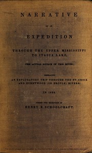
Narrative of an Expedition Through the Upper Mississippi to Itasca Lake, the Actual Source of This River Embracing an Exploratory Trip Through the St. Croix and Burntwood — A Closer Reading

(1 User reviews)   313
In Category - Exploration
Schoolcraft, Henry Rowe, 1793-1864 Project Gutenberg 2021 Not confirmed
Dakota Indians; Minnesota -- Description and travel; Ojibwa Indians; Indians of North America -- Government relations; United States -- Discovery and exploration; Mississippi River -- Discovery and exploration; Natural history -- Minnesota; Ojibwa language; Saint Croix River (Wis. and Minn.) Readers of public-domain and historical texts
Project Gutenberg digital edition en

Edition facts

Words 109,024
Reading time 475 min
Text sections 28

Before opening Narrative of an Expedition Through the Upper Mississippi to Itasca Lake, the Actual Source of This River Embracing an Exploratory Trip Through the St. Croix and Burntwood — A Closer Reading, the edition data offers a quick orientation: 109,024 words, 7 hr 55 min estimated reading time, and 28 detected text sections.

The text analysis averages about 17.8 words per sentence, while the detected sections provide another way to judge how the source is divided.

Project Gutenberg metadata also associates the work with “Dakota Indians,” connecting these edition facts with the source record’s subject description.

Schoolcraft's 1832 expedition narrative blends diplomatic mission to end Ojibwa-Sioux hostilities with geographical discovery of the Mississippi's source at Itasca Lake, incorporating natural history, linguistic analysis, and botanical catalogues.
Share
Editorial Edition Score 4.9/5

Calculated from edition completeness, EPUB availability, text structure and catalogue metadata. Not a user rating.

How this score is calculated
  • Description quality20 pts
  • Title & short description10 pts
  • Source metadata20 pts
  • Text length15 pts
  • Chapters / structure15 pts
  • EPUB file integrity20 pts

Total of 100 points, scaled to a 2.5-5.0 range. Editions with an empty description or a missing EPUB file are not scored.

Edition quality

Read the Text

or the objects above specified, and no opportunity was omitted to acquire statistical and other information suited to aid in the formation of correct opinions respecting their condition, and the policy to be pursued respecting them.

The portion of country situated between the bands of Lake Superior and the Mississippi, south of St. Anthony’s falls, occupied the summer of 1831. The area extending thence north, to the source of the Mississippi, and the Hauteur des Terres, forming the elevation separating its waters, from the streams received by Hudson’s bay, constituted the object of the expedition of 1832. So much of this area, as lies north of a latitude line passing through Cass lake, and west of about its parallel of longitude, comprehends the principal topic of description in the following work. And it is thus distinguished, from other portions of the western country, brought into discussion, in my two previous volumes of travels.

HENRY R. SCHOOLCRAFT. _Detroit, October 10, 1833._

NARRATIVE OF AN EXPEDITION THROUGH THE UPPER MISSISSIPPI, TO ITASCA LAKE.

_Introductory observations on the sources of the Mississippi.—Pike’s expedition in 1805, for exploring its course, and ascertaining its origin.—The expedition of Gov. Cass, directed to the same objects, in 1820.—Its extent, termination, and results.—Renewed efforts to ascend to its source, by the author, in 1831.—Diverted to the unexplored country lying in the area between Lake Superior and the Upper Mississippi, south of St. Anthony’s Falls.—Summary of the route.—The St. Croix and Chippewa Rivers.—Massacre of the Monomonees at Prairie du Chien, in 1831.—Mine country.—Return to the Straits of St. Mary._

_Farther observations on the exploration of the Upper Mississippi, and the discovery of its source.—An expedition authorised by the United States government, in 1832.—Its organization, objects, and route.—Leaves St. Mary, and proceeds through Lake Superior.—Sketch of this lake.—Notice of the murder of Brunet, by an Indian, in 1831.—Mission at Lapointe, or Chagoimegon.—The importance of this point in Indian history.—Mongozid, Wahbojeeg.—Meet Ozawindib, at the Brule.—Route to Sandy Lake, on the Upper Mississippi.—Portages on the St. Louis.—The Savanne portage.—Sandy Lake.—Assassination of Mr. Kay._

_General arrangements for the route of the expedition on the waters of the Upper Mississippi.—The width of this stream and Sandy Lake ascertained.—Notices of the ascent from that point by the Falls of Peckagama and Lake Winnipec, to Cass Lake.—Attack of a party of Mandans on the Chippewas at Pembina.—The route of the Bogottowa Lake.—Encamped at Winnipec House.—Inquiries respecting the opposition trade, and the traffic in ardent spirits.—Reach Cass Lake.—The width of the Mississippi, at its outlet.—Encamped on an island in this lake.—Yellow Head’s town; its population and hunting grounds.—Remarks on the Fur Trade.—North West, Hudson’s Bay, and American Fur Companies.—Lord Selkirk’s triumph.—Murder of Owen Keveny._

_Brief detail of transactions at Cass Lake.—A select exploring party is organised here, for ascending to the actual source of the Mississippi.—Council with the Indians.—Speech of Oza Windib.—The Indians furnish canoes and guides.—Arrangement of the party.—Notice of a Warrior’s widow.—Scalp dance.—Facts respecting foreign interference in the trade of the Upper Mississippi.—The question of the use of ardent spirits in the trade.—Act of Congress of 1832, prohibiting it.—Departure of the exploring party.—Ascent to Pamitchi Gumaug, or Lac Travers.—Its elevation and size.—A Shingaba Wossin.—Image worship.—Bay.—Ultimate forks of the Mississippi.—Ascend the east fork.—Lake Marquette.—Lake La Salle.—Kubbakunna Lake.—Notices of the Natural History._

_Ascent of the east fork of the Mississippi, from Kubbakunna Lake to the Naiwa rapids.—Its productions.—Indians kill a deer; their mode of dissecting it.—Reach the foot of Naiwa rapids.—The Naiwa portage.—Copper-head snake.—Zoned agate.—Journey from thence to Ossowa Lake, the source of this branch of the Mississippi.—Mistake in the latitude.—Portage from the east to the west branch.—Hauteur des Terres.—The height of land between the Hudson’s Bay and Gulf of Mexico waters.—Geographical notices of its extent.—Its natural productions.—Its geology.—Arrival at Itasca Lake._

_Outlines of Itasca Lake.—Its scenery and productions.—Forest trees, deer, fish, shells.—Width of its outlet.—Altitude above the ocean.—Length of the Mississippi.—Its course above Cass Lake.—Its origin south of latitude 47 deg. 16 minutes.—General observations on the Mississippi.—Erect a flag on the island in Itasca Lake.—Commence the descent of the West, or Itascan branch of the Mississippi.—Character of its channel.—Rapids and plateaux.—Falls of Kakábikons.—Portage.—Encamp at Pine Banks._

_Continuation of the descent.—Velocity of the rapids.—One of the canoes is upset, and its contents carried over the falls.—Notices of the vegetation and zoology.—Fork-tailed hawk.—A novel species of lizard.—The Yellow Head’s failure in hunting.—Instinct of the saw-billed duck in preserving its young.—The river continues to exhibit a succession of rapids and plateaux, during its passage through the alpine region.—Purity and frequency of springs on its banks.—Influx of the Cano and Piniddiwin rivers.—Notice of an inroad and murder committed by the Sioux in former years.—A night descent.—Some of its incidents.—Reach the junction of the east and west forks.—Return to Cass Lake.—Observance of the Sabbath.—Missionary field of labor in the northwest.—Superstitions and idolatry of the Indians.—Their name for the Deity.—Its probable derivation._

_Council with the Chippewas at Cass Lake.—Speeches of Oza Windib, Neezh Opinais, and Wai Wain Jeegun.—Distribution of presents.—Geographical and Geological notices of Cass Lake.—Colcaspi Isle.—Allen’s Bay.—Pike’s Bay.—Heights and distances.—Tributary of Turtle River.—Turtle Lake.—Portage from Cass Lake to Leech Lake.—Hieroglyphic marks.—Moss Lake.—Reach Lake Shiba.—The source of the River Shiba flowing into Leech Lake.—Traverse Leech Lake at night, and encamp at Guelle Plat’s village.—Received by the Indians with respect.—Description of Leech Lake.—Its population and principal Chiefs.—Warlike character of the Pillagers.—Efforts made by them to defend the Chippewa frontiers.—Their warfare defensive._

_Transactions at Leech Lake.—Notice of the Pillager band.—Their chief, Aish Kibug Ekozh, or the Flat Mouth.—He invites the agent and his interpreter to breakfast.—His address on concluding it.—Vaccination of the Indians.—A deputation from the Rainy Lake band is received, and a flag presented to their leader, The Hole in the Sky.—Council with the Pillagers.—Speech of Aish Kibug Ekozh, in which he makes an allusion to Gen. Pike.—He descants on the Sioux war, the Indian trade, and the interdiction of ardent spirits.—Personal notices of this chief._

_Observations on the Leech Lake Chippewas.—Data respecting the former state of the fur trade.—Their turbulent character.—Assassination of Relle by Puganoc.—Causes of the emigration of the North-western Indians.—The unsatisfactory character of their traditions.—Their language.—Brief synopsis of its grammatical structure._

_Encampment on a peninsula in Leech Lake.—Departure for the portage to the source of the De Corbeau river.—Traverse a bay.—Commencement of the portage.—The mode of passing it.—First portage to Warpool Lake.—Pass successively Little Long Lake, the Four Lakes, Lake of the Mountain, Lake of the Island, and encamp at the Kagi Nogumaug or Longwater, the source of the De Corbeau.—Are visited by the Chief of the Pillagers, who performs a journey for that purpose.—Recognize in his attendant the murderer of Gov. Semple.—Narrative of facts leading to this event.—Commence the descent of the river De Corbeau, passing successively the Longwater, Little Vermillion, Birch Ple, Boutwell’s Vieu, Desert, Summit, Long-rice, Allen’s, Johnston’s, and Leelina Lakes.—Junction of the Shell River fork.—Encamp in a storm._

_Further descent of the De Corbeau.—Remarks on its general course and character.—Junction of Leaf and Long Prairie Rivers.—The latter pursued by the Pillagers in their wars against the Sessitons and Yanktons.—Cause of the appellation of Mukkundwa.—Their robbery of Berti, and assertion of a belligerent principle.—Forest trees of the De Corbeau.—Monotony of its scenery.—Meeting with a Chippewa hunter.—Arrival at the mouth of the river, and entrance of the Mississippi.—Concourse of Indians assembled at that point.—Council with them.—Sketch of the speeches of Grosse Gueule, Soangikumig, and White Fisher.—Arrival of the Pierced Prairie.—First intelligence of the breaking out of the Sauc War.—Close of the Narrative.—Notice of the effects of the disuse of ardent spirits by the men, and the observance of the Sabbath._

EXPLORATION OF THE ST. CROIX AND BURNTWOOD RIVERS.

_Interval of the banks of the Mississippi, between the mouths of the River De Corbeau and St. Croix, adverted to.—Plains above St. Anthony’s Falls, agricultural.—Fact respecting the recession of the bison.—Geological change in the character of the Mississippi, in crossing 45 deg. parallel.—Fort Snelling.—Council.—Reach the mouth of the St. Croix.—Picturesque character of St. Croix Lake.—Traits of its natural history.—Encamp near a diminutive kind of barrows.—“Standing Cedars.”—An Indian trader.—Green-stone rock.—Falls of the St. Croix.—Traditionary account of an ancient Indian battle, fought at these falls by the Chippewas, Saucs, Foxes, and Sioux.—Wahb Ojeeg._

_Ascent of the St. Croix above the falls.—Direct the burning of illegal trading houses.—Snake River.—Its chief, Pezhicki.—Notices of Snake River.—Its population and trade.—A foreign trading company formerly located here.—Effects upon the Indian intercourse of the present day.—Anecdote of the former mode of using rum and tobacco.—Kettle Rapids.—Shell River.—A hunting party of Chippewa boys.—Pokanokuning, or Yellow River.—Its population and trade.—Notices of its natural history.—Shells.—Prairie squirrel.—Widow of a murdered Indian, called the Little Frenchman, declines having her son put to school.—Reach the forks of the St. Croix.—Notice of the Namakagon Branch.—The chief, Kabamappa.—Women’s Portage.—The Sturgeon Dam.—Kabamappa’s village.—Upper St. Croix Lake._

_Character of the St. Croix.—Its productiveness in wild rice.—Population and trade.—Condition of the Indians, and their prospect.—Portage to the Burntwood.—Marine sand formation.—Bass lake.—Character of the Burntwood river.—Arrival at its discharge into Fond du Lac of Lake Superior.—Indian friends.—Close of the Narrative.—Brief general remarks on the condition of the Chippewas.—Traits of character and government.—The institution of the Totem.—Tale of the origin of White Fish._

III. OFFICIAL REPORTS

NARRATIVE OF AN EXPEDITION THROUGH THE UPPER MISSISSIPPI, TO ITASCA LAKE.

_Introductory observations on the sources of the Mississippi.—Pike’s expedition in 1805, for exploring its course, and ascertaining its origin.—The expedition of Gov. Cass, directed to the same objects, in 1820.—Its extent, termination, and results.—Renewed efforts to ascend to its source, by the author, in 1831.—Diverted to the unexplored country lying in the area between Lake Superior and the Upper Mississippi, south of St. Anthony’s Falls.—Summary of the route.—The St. Croix and Chippewa Rivers.—Massacre of the Monomonees at Prairie du Chien, in 1831.—Mine country.—Return to the Straits of St. Mary._

American geography may be said to have had three important problems to solve, in modern times. The first and second of these, related to the source of the Missouri, and to the course and termination of the Columbia. Both, were substantially resolved by the expedition of Lewis and Clark, under the administration of Mr. Jefferson. It is to be borne in mind, however, that but one of the three forks, up to which the Missouri was traced, has been explored, that its two northwestern branches have not been ascended, and that, consequently, we do not actually know, which of its primary tributaries is the longest, or brings down the greatest volume of water.

The true source of the Mississippi, which forms the third topic of inquiry, was brought into discussion at the same period. And immediately after the acquisition of Louisiana, the American government sent an officer, with a suitable body of men, to determine it. Lieut. Pike, who was selected for this service (who, nine years afterwards lost his life as a general in the service, at the taking of York) did not, however, set out early enough in the season (1805) to accomplish the object. After the selection and purchase of the site, on which the fort near the Falls of St. Anthony, is now situated, he encountered delays in ascending the rapids characteristic of that part of the Mississippi. Winter overtook him before reaching the junction of the De Corbeau. He prepared for its severities by erecting a block house, for the security of his provisions and men. He then proceeded with a small detachment, on snow shoes to Sandy Lake, and Leech Lake; two points of central influence, which were then occupied by the North West Fur Company. As the partners of this company consisted of foreigners, and their operations were continued after the legal transfer of the country to the American government, Lieut. Pike would have been justified in making a seizure of the valuable furs then in their possession. He did not, however, adopt this course, and exhibited a magnanimity in relation to it, which is in accordance with his subsequent acts of disinterested intrepidity. He collected the geographical data, which are embodied in his published map and journal, and returned from his wintry station, on the opening of navigation in the spring.

No further effort was made to explore the sources of the Mississippi, for several years. In 1820, Gov. Cass, then administering the government of Michigan Territory and exercising jurisdiction over Indian affairs, obtained the sanction of the general government to visit the region. He left Detroit, with a party of thirty-eight men, including the gentlemen composing his suit, during the latter part of May. He was supplied for a journey of four months. After traversing the coasts of Lake Huron, and visiting Michilimackinac, he proceeded north-westward, by ascending the primitive summit at the Falls of St. Mary, went through the extended and picturesque basin of Lake Superior, and first struck the waters of the Upper Mississippi at Sandy Lake. To this point he was accompanied by the military escort, and by the train of larger canoes employed to transport stores and baggage. But the fatigues which the men had undergone in crossing portages, added to the low state of the water, induced him to form a permanent encampment at this place. And he proceeded with a select party, in canoes to explore the Mississippi.

It was the middle of July when the expedition reached Sandy Lake, and the difficulty of subsisting so large a party in so remote a position, with the constant claims of suffering and hungry tribes, who presented themselves at every point, began to be severely felt. The exploring party, which was now organized, went out, under a sense of these circumstances, and with a feeling of the responsibility pressing upon the claims of the expedition in other quarters, which limited the time applicable to the ascent. They entered the Mississippi on the 17th of the month, and found a strong current, with alluvial banks, and a vegetation indicative of a fertile soil. For the distance of about one hundred and fifty miles, above this point, the party found no diminution in the average strength of the current, which was frequently accelerated by rapids. The latter then assumed a more formidable aspect for ten or a dozen miles, at the end of which they were terminated by the falls of Peckágama. At this cataract, the river, which below has its course through alluvial banks, densely wooded, is compressed between rocks of granulated quartz, over which it rushes with a velocity, which would seem to threaten destruction to any species of craft that should attempt the descent. It became necessary, at this point, to transport the canoes and baggage from two to three hundred yards over land.

On reaching the Peckágama summit, the channel of the Mississippi was found to flow more directly from the west, with a comparatively sluggish current. But the most distinctive trait of this part of the river was found to consist of a series of extensive savannahs, through which the river displays itself in the most elaborate windings. The junction of the Leech Lake branch takes place at this plateau, at the computed distance of fifty-five miles above the falls. After passing this point, the course of the river is again, generally, from the north-west, about forty-five miles to Lake Winnipec, a handsome body of clear water, estimated to be ten miles broad. The course of the ascent is then west, for about fifty miles, at which distance the river is found expanded into a more considerable lake, presenting an area of limpid water of, perhaps, 120 square miles. This sheet, which has subsequently been found to be the largest expansion of the Mississippi, is since denominated Cass Lake. It was the highest point reached. The party entered it on the 21st of July. The question of pursuing the stream further, was then submitted by Gov. Cass, to the gentlemen composing his party. Anxious as all were to see the actual source of so celebrated a stream, their wishes were controlled by circumstances. Inconveniences had been felt from leaving the supplies at so considerable a distance below, and as the waters were found to be low, and the preparations inadequate for a journey of indefinite extent, a decisive opinion was expressed in favor of a return from this point. This decision was immediately carried into effect.

From the best information that could be obtained, the Mississippi was represented to have its origin in a lake called _La Biche_, supposed to be sixty miles distant, in a north-west direction. Upon this estimate, the length of the river was computed to be 3038 miles, and by a series of approximate estimates, its altitude placed at 1330 feet above the Atlantic. Numerous rapids and lakes were, however, stated to exist in this remote part of the stream, and a degree of vagueness and uncertainty exhibited in relation to it, which evinced, that the traders, who were relied on for information, either, had seldom frequented it, or preserved an indefinite recollection of its geographical features.

Such was the state of public information on this point in 1820. A veil of obscurity was still cast about the actual source of the Mississippi, which there was no further attempt to remove for ten or eleven years. In 1830, the writer of these sheets was directed to proceed into the Chippewa country, north-west of Lake Superior, in the execution of duties connected with Indian affairs. But the instructions were received so late in the season, that their execution became impracticable until the next year. In the mean time, means for more extensive observation were provided, a physician and botanist engaged, and a small detachment of troops, under the command of a subaltern, ordered to form a part of the expedition.

This expedition numbering twenty-seven persons, exclusive of guides and Indian auxiliaries, employed on the portages, left St. Mary’s at the foot of Lake Superior, late in June 1831. After entering, and coursing around the shores of Lake Superior to Lapointe, it was found, from every representation, that the low state of the water on the Upper Mississippi, would render it difficult, if not impracticable, to reach the bands at its sources, during the drought of summer. Public reasons were, at the same time, urgent for visiting the interior bands, located between the group of islands at the head of Lake Superior, and the Mississippi—where a useless and harassing conflict was kept up between the Sioux and Chippewa nations.

Henry Rowe Schoolcraft’s 1832 expedition narrative is a hybrid document: part diplomatic mission, part geographical survey, part natural history catalogue. The preface reveals that the journey was ordered by the War Department to negotiate peace between the Chippewa (Ojibwa) and Sioux, yet the book’s title foregrounds the discovery of Itasca Lake as the Mississippi’s source. This tension between political and scientific objectives shapes the text’s structure, which intersperses travelogue with botanical lists, linguistic lectures, and ethnographic observations.

The excerpts show a work deeply engaged with classification—of plants, languages, and peoples—but the catalog subjects (e.g., “Dakota Indians,” “Ojibwa Indians”) are not evenly treated in the available passages. The botanical appendix and linguistic lectures dominate, while direct encounters with Indigenous groups are largely absent from these samples, suggesting the narrative may prioritize systematic knowledge over narrative action.

Botanical Catalogues as Evidence of Method

The excerpts include a lengthy list of plant species with Latin binomials and locations—e.g., Silene antirrhina at “Lac la Biche,” Zizania aquatica from “Illinois to the sources of the Miss.” This appendix, occupying several pages, reflects Schoolcraft’s training as a naturalist and his commitment to Linnaean taxonomy. However, the list is almost entirely detached from the narrative; it provides no ecological context or Indigenous uses. The catalog subjects include “Natural history – Minnesota,” but the excerpts reveal a practice of collection and naming that treats the landscape as a specimen cabinet. Readers expecting a continuous travel story will encounter these systematic interludes as interruptions, yet they are central to the book’s scientific identity.

Linguistic Lectures and the Structure of Ojibwa

A substantial section titled “Indian Language” presents lectures on the grammatical structure of Ojibwa, delivered before the Algic Society. Schoolcraft focuses on the substantive, arguing that previous researchers overemphasized the verb. He claims the noun “continue[s] to perform its first offices, with less direct aid from the auxiliary parts of speech.” The excerpts show a detailed analysis of gender (animate vs. inanimate), number, and possession. This material is technical and presumes interest in philology. The catalog subjects list “Ojibwa language,” but the lectures are not ethnographic description; they are a formal linguistic treatise, complete with lecture numbers and theoretical claims. The connection to the expedition’s diplomatic goal—negotiating with Ojibwa leaders—is implicit at best.

The Expedition’s Dual Mandate: Peace and Discovery

The preface’s letter of instruction from the War Department orders Schoolcraft to “put an end to the hostilities between the Chippewas and Sioux,” but the book’s title emphasizes geographical discovery. The excerpts do not describe any peace council or treaty; instead, they pivot to botanical and linguistic appendices. This suggests that the narrative may subordinate the diplomatic mission to scientific and exploratory aims. The catalog subjects include “Indians of North America – Government relations,” yet the available text offers no evidence of how Schoolcraft conducted negotiations or interacted with Indigenous leaders. Readers should note that the excerpts are incomplete; the full work likely contains travel accounts and meetings that are not sampled here. The tension between these two purposes remains unresolved in the passages provided.

Schoolcraft’s narrative resists easy categorization. The excerpts reveal a work that is as much a scientific report as a travelogue, with extensive appendices on botany and linguistics that may test the patience of readers seeking a straightforward exploration story. Those interested in the history of natural science or Indigenous language study will find rich material; those expecting a continuous account of the Mississippi’s source may need to navigate around systematic digressions. The book’s value lies in its documentation of early nineteenth-century scientific practices and the intersecting agendas of exploration, diplomacy, and classification.

Schoolcraft’s quiet devotion to mapping every root and branch reminded me of wandering alone through a forest, not needing to reach the end. The way he noticed small things—a plant, a word—felt familiar, almost like a conversation I later had with James's Account of S. H. Long's Expedition, 1819-1820, part 3 — Reading Companion. That one lingered too, in a gentler way, like a footprint left beside my own.

Lucas Rivera
1 week ago

5
5 out of 5 (1 User reviews )

Add a Review

Your Rating *
  • ...
    Jeffrey Sanchez - 1 month ago
    {'rating': 4, 'text': "An engrossing account of exploring the upper Mississippi and attempts to trace it to Lake Itasca. The author's detailed journal keeps you engaged through every paddle stroke and portage. His encounters with Native American tribes, the rugged wilderness, and the challenges of mapping the river are vividly described. A valuable historical document for anyone interested in American exploration."}

  • ...
    Tyler Fowler - 4 weeks ago
    {'rating': 3, 'text': "A detailed expedition journal that offers a fascinating look at the American frontier and its native peoples. The author's descriptions of the landscape and the river are evocative, and his scientific observations are valuable. However, the narrative is sometimes slow and the writing can be dry, making it more suitable for dedicated historians than casual readers."}

  • ...
    Cathy Ramos - 2 weeks ago
    {'rating': 2, 'text': 'The book is burdened by excessive genealogical and survey data that detracts from the narrative. The author is more concerned with scientific measurements than storytelling. While the historical value is undeniable, the prose is often terse and repetitive. The lack of maps in the text is also a significant flaw. Only for the most academically inclined readers.'}


Reader reflection

What did you think of this book?

Answer a few questions and save a private reflection on this device.

Your progress 0 / 10
1

How far have you progressed with this book?

2

How did the book work for you overall?

3

Would you pass this book on to a friend?

4

How demanding did the text feel?

Related eBooks